What shall we do?
We help businesses and public authorities to plan, manage and improve their activities in the marine environment.
We offer environmental studies, technical support for coastal and maritime projects, advice on regulatory compliance, and solutions to help organisations operate more safely, efficiently and sustainably.
Our key services include:
- Environmental Monitoring
- Water Quality
- Sediment Quality
- Seabed Surveying
- Marine Geophysics
- Marine Communities
Environmental Monitoring
Environmental monitoring in marine consultancy refers to the range of studies, checks and monitoring activities carried out to assess how human activities affect the marine environment and to ensure compliance with the environmental requirements set out in the regulations.
At Eurofins, we carry out environmental monitoring, including:
- Dredging.
- Port works.
- Cable laying.
- Installation of outfalls.
- Aquaculture facilities and farms.
- Thermal and combined-cycle power stations.
Water Quality
- Water quality studies in port, coastal and near-shore environments.
- Oceanographic surveys.
- CTD profiles and in situ measurements of the water column.
- Biological sampling of planktonic communities, macroalgae, etc.
- Physical-chemical and microbiological analyses, toxicity testing, microplastics and environmental DNA.
Sediment Quality
- Sampling and in situ measurements of surface sediments and deep-sea sediment cores.
- Laboratory analysis of sediments.
- Environmental assessment of dredging, aggregate extraction and beach nourishment.
- Analysis of marine sediments in accordance with the Guidelines for the Characterisation of Dredged Material CMD 2021.
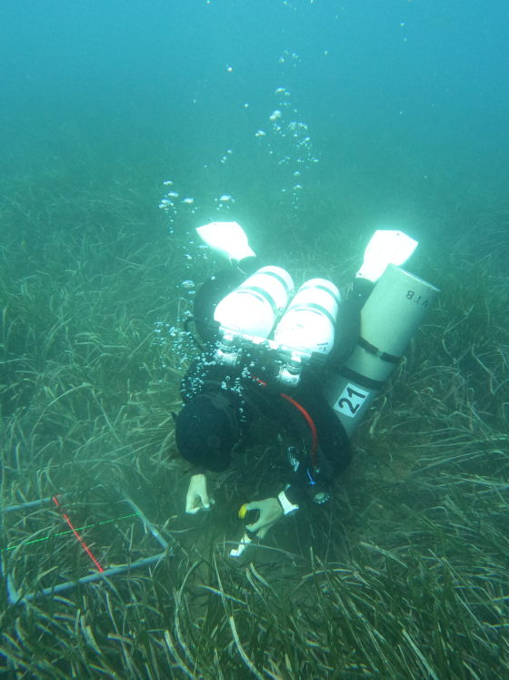
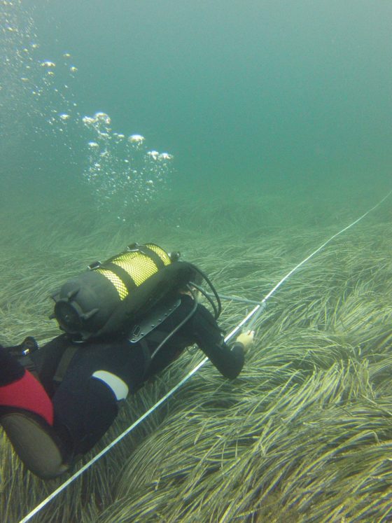
Direct seabed exploration
- Marine biocoenoses: Seagrass beds (Posidonia, Cymodocea, Zostera) and communities on soft or rocky seabeds.
- Hydrographic and video surveys.
- Oceanographic services.
- Professional, scientific and technical diving.
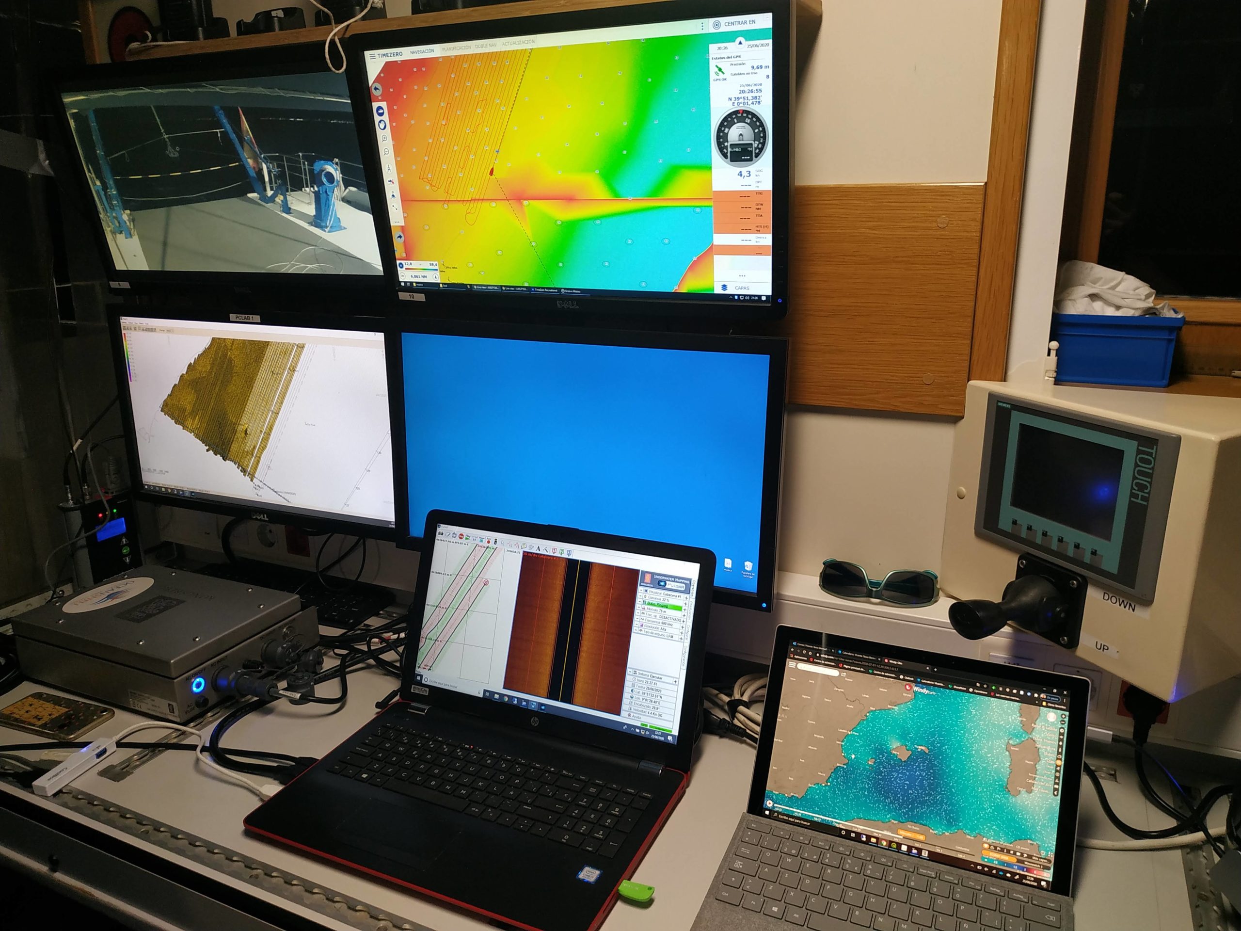
Geophysical surveying of the seabed
- Topobathymetry: LIDAR and multibeam.
- Benthic mapping: Backscatter and side-scan sonar.
- Sediment mapping: Multibeam, SBL, profiler and high-resolution seismic.
- Magnetometry and gravimetry.
- Coastal dynamics studies.
- Underwater acoustics studies and measurements.
- Electromagnetic field measurements.
Marine communities
- Mapping of coastal communities using the CARLIT index.
- Studies of planktonic communities (phyto- and zooplankton).
- Characterisation of seagrass meadows (Posidonia, Cymodocea, Zostera) using the POMI and CYMOX indices.
- Benthic macrofauna in sediments on hard and soft substrates.
- Habitats of Community Interest.
- Habitat assessment and restoration.
Our High-Tech Equipment
Water monitoring and sampling
- Multiparameter probe.
- High-resolution CTD.
- Oceanographic bottle (Niskin)
Sediment sampling
- Draga Van Veen.
- Draga Shipek.
- Boxcorer.
- Corer / Gravity corer.
Topobathymetry, geophysics and marine cartography
- LIDAR photogrammetry.
- Side-scan sonar.
- Backscatter.
- Bathymeter.
- Geopulse and Sparker.
- Underwater tomography equipment.
- Magnetometer.
- Electromagnetic field equipment.
Underwater inspection/remote sensing
- Generic ROV.
- SEABOTIX vLBV300 ROV (georeferenced).
- Towed video camera (georeferenced).
- Professional/scientific diving equipment.
- Scuba diving.
Marine biology
- Equipment for sampling phytoplankton, zooplankton and benthic macroinvertebrates.
Imaging and remote sensing
- Satellite imagery.
- Drone.
- Underwater filming and photography (ROV or diving).
- Underwater photogrammetry.
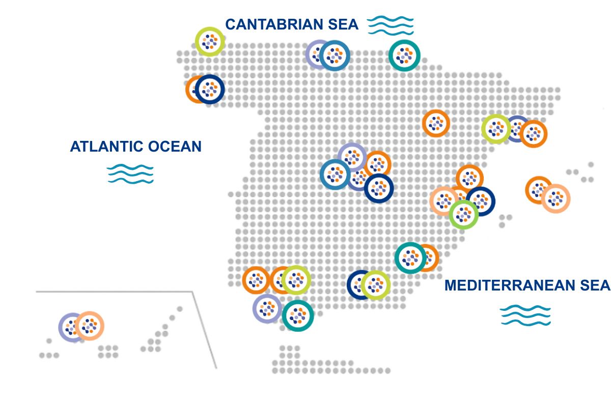
Sampling at any location in Spain
Thanks to our extensive network of laboratories and technical staff across the country, and our ability to transport vessels overland, we can respond swiftly anywhere in Spain, ensuring regulatory compliance and reliable results.